Vihren peak in winter: how we climbed it from Shiligarnik on the second attempt
Vihren peak (2914 m) is the second highest peak in Bulgaria and one of the most serious winter climbs in Pirin. We climbed it by the classic route from Shiligarnika, after our first attempt ended with a return from Mt. Khvoinati because of thick fog. If anyone is interested here is also a link with our first attempt attached
How did we get to Shiligarnika and what do you need to know about the parking lot?
The parking lot at Shiligarnika has two rates - day (from 7:00) and night (from 19:00), each at 13 euro. If you leave the car before 7am and return after 7pm, you'll pay both - 26 euros in total. That's exactly what happened to us on our first attempt.
We were more creative this time 😀 . We arrived at 6:45 and parked just before the barrier, outside the paid area. The difference? Zero euros (there was even room for 2 more car-tactics like me). On the first attempt Stefo didn't want to leave his brand new car outside the barrier - he was still scared of having it stolen - but this time we were in my not-so-new car😀.
How is the road from Shiligarnika to the Vihren hut?
We drove on the asphalt road (now of course it was like a ski slope), on which snowmobiles had passed - most likely from the PSS recently. The road was well trodden and comfortable to walk on, there were old tracks of people who had passed a few days before us. It's a single track and not easy to get confused, even in winter (especially if you've been in summer).
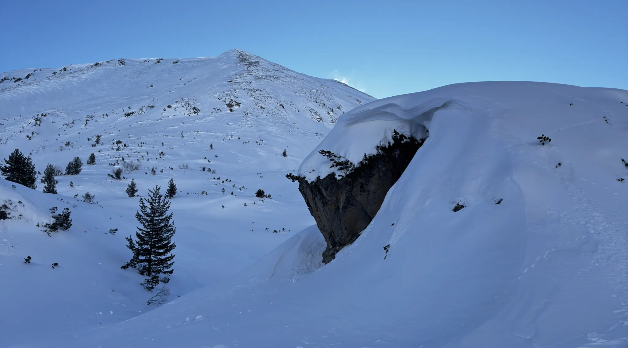
We ran to the bridge at the inn where we had two options - along the river or the summer road through the Baikusheva mura. We opted for the road that almost every year an avalanche had already fallen on (two weeks ago). It falls after about a kilometer on the road above the Baikusheva mura, the view is impressive because the ice blocks from the avalanche had blocked the road. On the way the road signs, which are about 2 meters high, were almost buried in the snow.
We passed by the Vihren hut without stopping. This time we were motivated - we knew the weather was with us, and we didn't want to lose momentum.
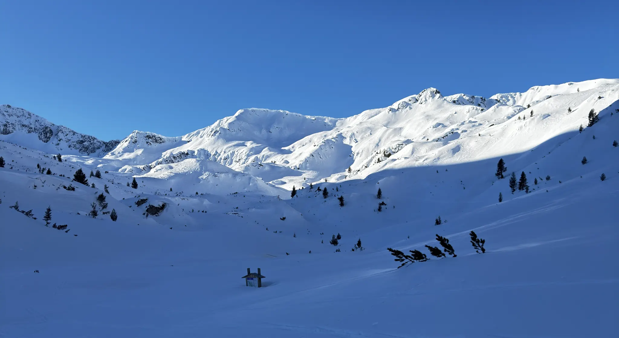
What awaited us at Muratovo Lake
At 9:38 we stepped onto the frozen Muratovo Lake. The Banderich Cirque spread out before us - the sun was beating down hard, the snow was moderately settled, but there was no drift. We decided to have breakfast right here, with these brutal views for a backdrop.
Stepho launched the drone and "went" with it near Vihren - our target. Behind us in the distance we could hear voices in a language unrecognizable at the moment. They turned out to be ski mountaineers, who were slowly catching up with us, skiing.
After a short break we continued to peak Hvoinati (2635 m) - a granite peak, also known as Ovinati. The name comes from the local Banskali dialect, where "ovina" means juniper. Juniper bushes grow on its slopes, but of course they were nowhere to be seen.
How did we get from Hvoinati to Vihren?
On Hvoinati we were caught up by the ski mountaineers - I already recognised their language - French. We greeted each other and they headed to Vihren via Vihren Pass (Kabata). It is at Kabata that the marbles that make up Vihren give way to the granites of Khvojnaty, of course this fact cannot be seen in winter 😀.
We descended to the wooden sign for the E4 trail - we got there at 11:20. For comparison, on our first attempt(with the brutal fog) we were at Mt. Juniper as late as 13:30.
The E4 Trail (the Trail of the Five Mountains) connects Vitosha, Verila, Rila, Pirin and Slavyanka and has a distance of 260 km - from Dragalevtsi to Gotsev Peak (2213 m) on the Bulgarian-Greek border.
We made an important decision here - we left the snowshoes. We stuck them in the icy snow a little bit away from the trail and lightened our weight by almost 2 kg. Uphill, we weren't sinking as much anymore and they would only weigh us down.
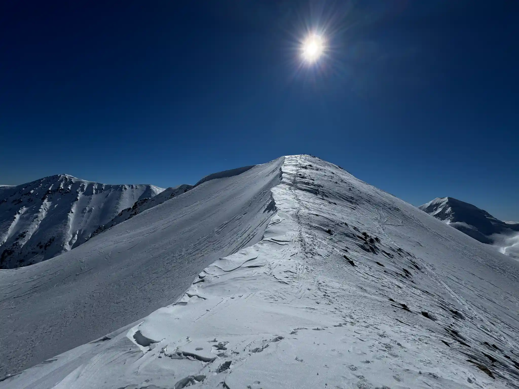
We put the crampons down and started up. Ahead of us - about 300 meters of vertical to the very top of Vihren. The climb was in serpentines - zig-zagging up the slope. The crampons proved to be unnecessary - on the south side of Vihren the stormy winds had blown the snow away and in some places near the Jamdzhiev rim even bare rocks were visible.
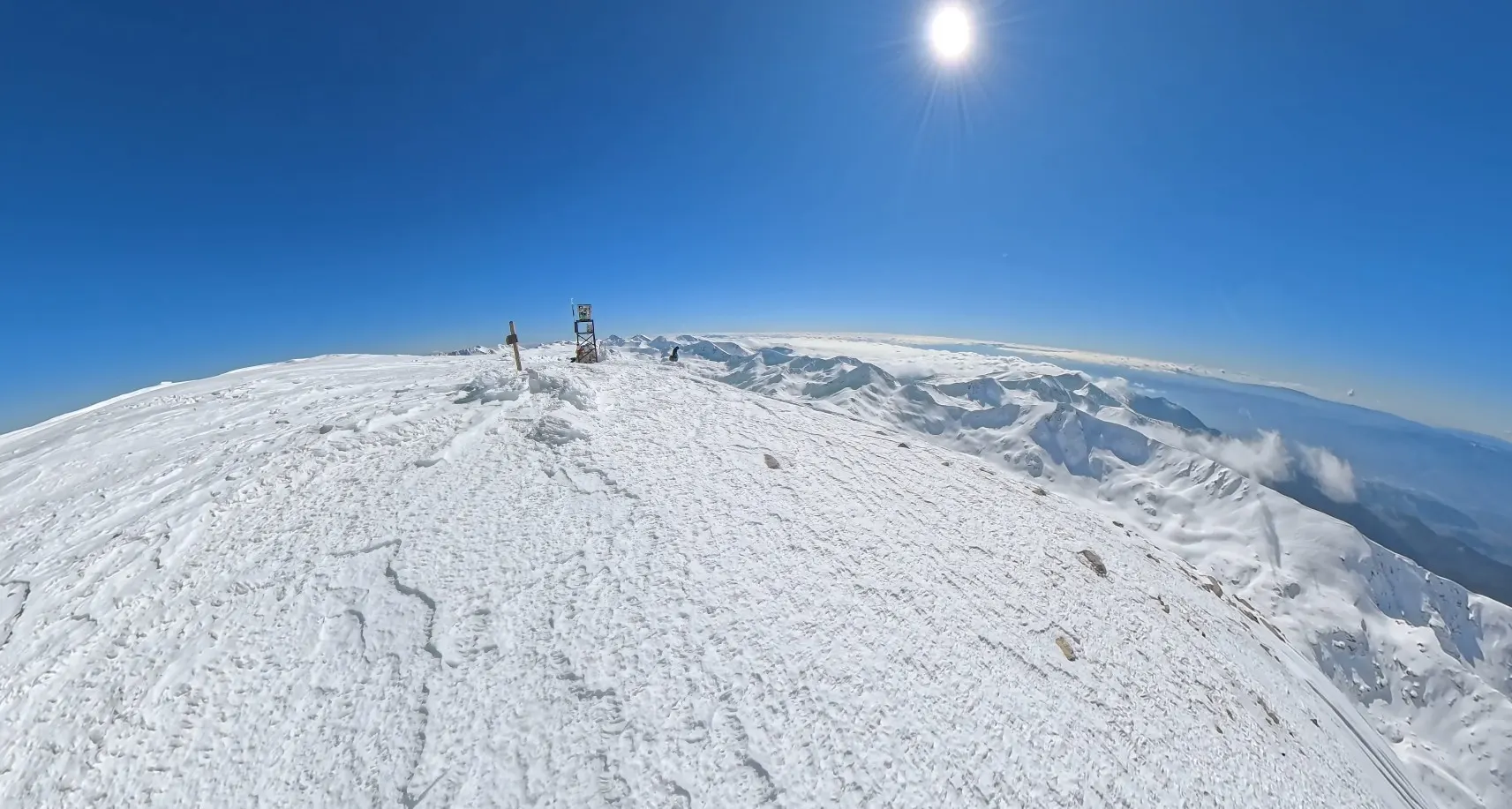
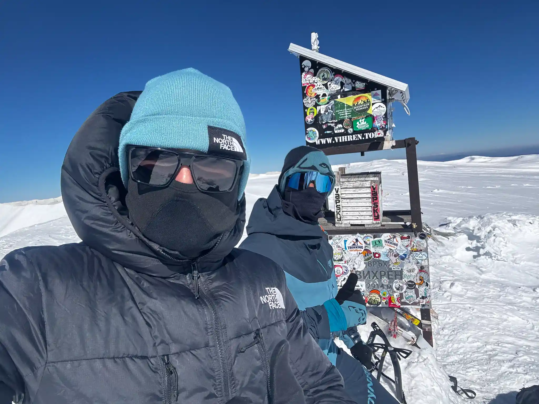
After about an hour of climbing on the slope, we were at the peak of Vihren (2914 m).
What did we see from the top of Vihren?
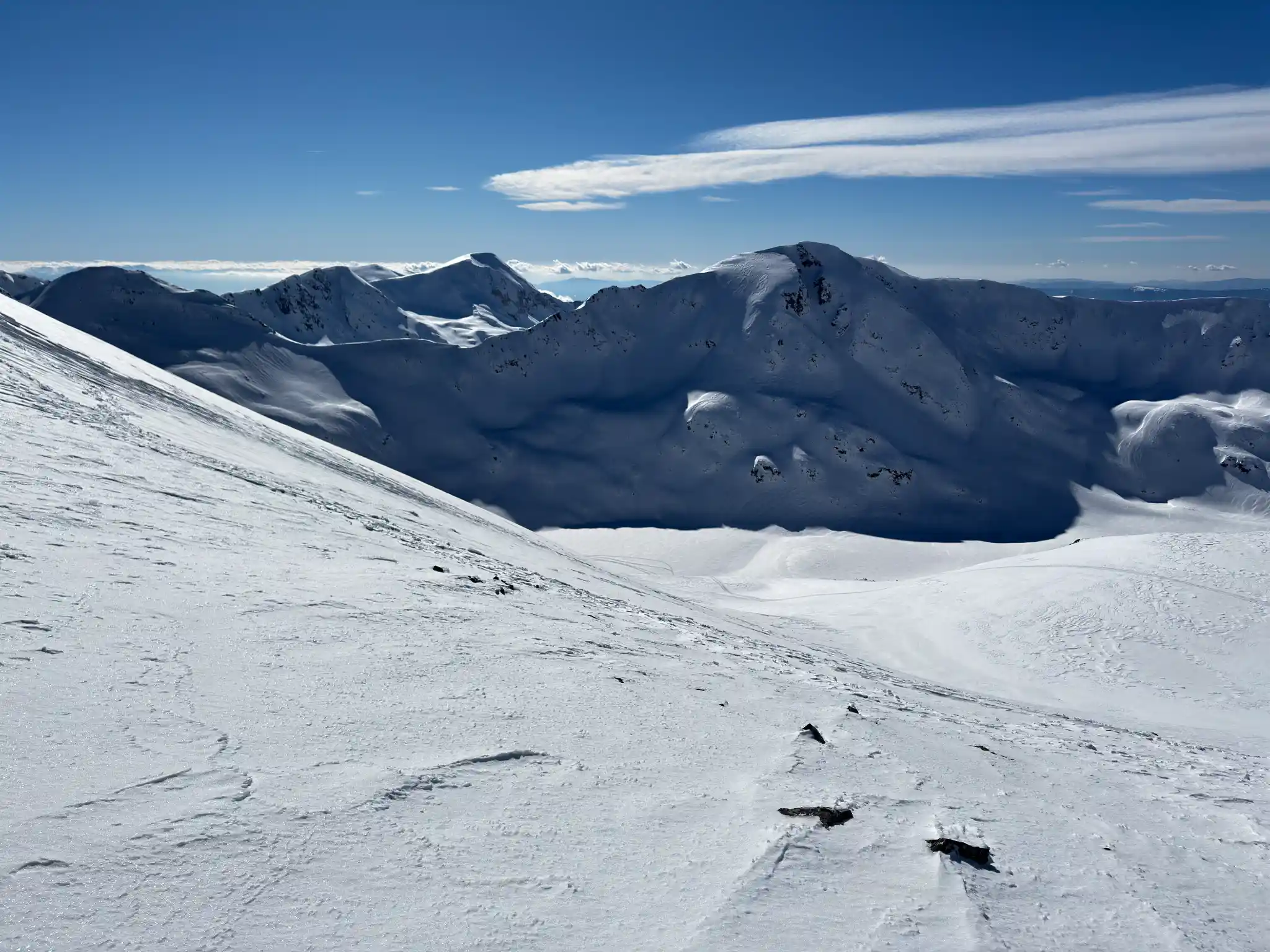
The panorama was unreal. Without a single cloud in the sky we could see the whole marble ridge - Kutelo 1 and 2, Konchetto, Banski сухоdol, Bayuvi holes in the distance, Albutin, Koteshkiya chal. Bansko was visible in the lowlands, and behind it - Razlog. A view that makes you make a second attempt.
Stepho released the drone to capture the panorama and... just then a brutal wind, typical of Vihren, popped up out of nowhere. Such a wind that it moved my already almost emptied backpack. The temperature dropped from 5-6°C in the sun to -7/-8°C within minutes. Instantly we put on thicker jackets and gloves, which were unnecessary by this point.
Vihren lives up to its name - the peak is famous for its whirlwinds. We saw a few snow flurries that resembled mini tornadoes, but were unable to get a good shot of them as they quickly dissipated. Vortex wind is no joke - it comes suddenly and can take you completely by surprise. Always wear warm clothes and windbreakers, even in the summer.
How did we get home and what are the main takeaways
We returned along the same route - a total of 21km for the day. Our friends Stoil and Vancho (Ivan) were waiting for us in Bansko, they came by car because they had no opportunity for a second attempt (it was Friday and they were at work and we were on vacation). We sat down for some soup and a beer - a well-deserved reward after such a trek.
The most important lesson? The plain will not escape. The first time the Pirin didn't let us - dense fog, zero visibility, navigation entirely by GPS. Then we came back from Khvojnaty ruined. And now we grumbled that we had no sunscreen because there was not a cloud. Of course, we prefer the second option to the first😀.
As long as one is willing - one can always return.
How long does it take to climb Vihren from Shiligarnik in winter?
Our pace was moderate, two people, as we followed the weather forecast for the last three days of the trek. Here are the times:
Start from Shiligarnika - 6:45
Muratovo jezero - 9:38
Tabela E4 (after Khvojnaty)11:20
Vihren Peak (2914 m)~12:30
Total distance21 km
Displacement ~1400m
Frequently asked questions
Do you need snowshoes for Vihren in winter?
Yes, snowshoes are almost mandatory from Vihren hut to or shortly after Khvojnaty. Without them you fall quite a bit in the deep snow (in warm weather, no flurries). We left them at the sign on E4 (Vihrenski Preslap - Kabata), or just before the final ~300 meters of vertical drop, because the snow there is often blown away by strong winds.
How hard is the winter climb of Vihren?
The route from Shiligarnika is the classic and most accessible winter route, but don't underestimate it. The distance is 21 km, the vertical drop is about 1400 m and the conditions can change in minutes. On our second attempt, the temperature at the top dropped from +5°C to -8°C literally in seconds. You need good physical preparation and the right equipment.
Is there a danger of avalanches on the route?
Yes, there are avalanche dangerous sections - mostly above the Baikusheva Mura and on the eastern slopes of Vihren. We even went through the avalanche that falls almost every year from the "Metlata" chute. Check the avalanche bulletin before each ascent and avoid sections with slopes above 30° in unstable snow cover or fresh new snow.
When is the best time to climb Vihren in winter?
February and March usually offer the most stable conditions - the snow has often settled and the day is longer. Don't set off if it has snowed again in the previous few days. We walked on a clear winter day with perfect visibility and sunshine. Most important is the weather forecast - if it promises fog or storms, don't go. We speak from experience.
Can you do it without a mountain guide?
You can, but only if you have winter mountain experience, the right equipment (snowshoes, crampons, GPS) and can read the weather. In poor visibility the route is difficult to navigate - on our first attempt we navigated entirely with GPS because of the fog, we never reached the summit.
Finally
A winter climb is one you never forget. Even if the first attempt doesn't work out - as it did for us - the mountain can show you its better face the second time around. Crystal clear skies, a marble ridge without a single cloud, and whirlwinds that remind you who's hosting.
If you're planning a winter climb of Vihren, prepare well, keep an eye on the forecast, and remember - if the weather is bad, come on another day, the mountain isn't going anywhere.
📹 Check out the full video of the climb on our Peak Hunters BG YouTube channel.